
Mapping the Pacific’s COVID-19 success
Researchers at The Australian National University (ANU) have created an interactive map that tracks Pacific responses to COVID-19 and assesses what is working and what is not.
The map, believed to be the first of its kind, has snapshots of local responses of all Pacific countries, alongside links to ANU analysis.
The map is published by ANU specialist website Policy Forum, and brings together expertise from ANU CartoGIS, the Australia Pacific Security College at ANU and the ANU Department of Pacific Affairs.
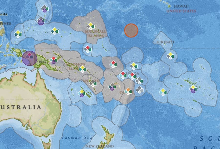
The researchers hope the map provides important data and insights for researchers, public servants and members of the public.
“The COVID-19 interactive map has been produced to make it easier to keep people informed,” Professor Meg Keen, the Director of Australia Pacific Security College, said.
“It ensures we are sharing our experiences and policy responses with each other so we can learn and adapt to changing and challenging circumstances.”
The development of the map has “a world of data” on offer to help create the best possible understanding of COVID-19’s effect on the Pacific region.
“This interactive map is a window into repositories of data and commentaries, presented in a way that allows the user to explore, understand and engage with it productively,” CartoGIS Services Manager Kay Dancey said.
While the world has its focus on the US, Europe and Asia, ANU experts have been putting their focus on the Pacific region, which they say has had an excellent response to the pandemic.
New Caledonia, Fiji and Timor-Leste have eradicated all known cases, Papua New Guinea has two active cases while countries such as Micronesia and Samoa have not had a COVID case since the crisis began.
The researchers say the map can help create a greater understanding of the policy initiatives of these countries, providing valuable lessons for other nations around the globe.
“With events unfolding at such a rapid pace, it is more important than ever we contextualise the data that is being circulated with an informed view,” Associate Professor and Head of the Department of Pacific Affairs Nicole Haley said.
“This map and analysis comes from researchers and scholars who are on the ground, observing and analysing government responses and their impact on communities in the region in human terms.”
The Policy Forum mapping of the Pacific COVID-19 response has regular weekly updates and can be accessed here.
Contact the media team
You may also like

Free online training launched to improve volunteer dementia care in hospitals
Golden Angels training equips hospital volunteers with practical skills to improve dementia and delirium care across Australia.

Aboriginal and Torres Strait Islander Peoples’ access to Country now a climate and health measure
For the first time, Indigenous-governed data on time spent on Country informs a key climate and health report.

ANU wellbeing research partnership identifying pathways out of disadvantage
ANU and the ACT Government have renewed their research partnership to better understand childhood disadvantage and improve wellbeing through evidence-based policies.